Housing estates & car parks

Site layouts,
optimised in minutes.

Airship Site Designer turns a site boundary into an optimised housing estate or car-park layout — roads, plots, parking and landscaping — then brings it to life in 3D and photoreal AI renders, ready for DXF, a planning-ready PDF pack or a native Revit model.

No CAD skills needed UK standards built in DXF · PDF · Revit export AI photo renders included
Airship — Riverside Phase 2
Three steps

A buildable layout in minutes, not days

No CAD licence, no steep learning curve — just your site and your rules.

1

Trace your site

Draw the boundary to scale — over a survey image or straight off the map — and set the entrance.

2

Set your rules

House types & mix, road and footway widths, gardens, bay sizes, green-space target — or load a standards preset.

3

Optimise & export

Generate the layout, walk it in 3D, then export DXF, a PDF planning pack or a native Revit model, share a live link — or create an AI photo render for the cover.

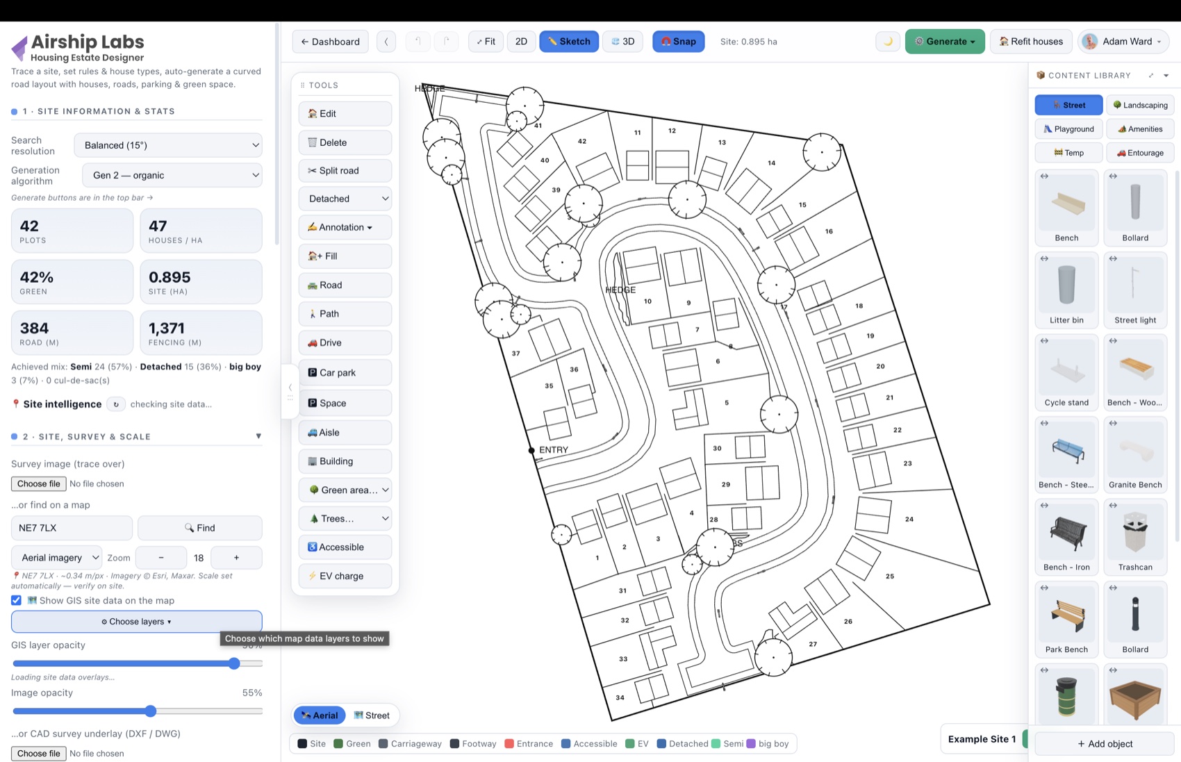
A generated housing-estate layout in Airship Site Designer's black-and-white planning sketch view
Planning-ready in minutesgenerated layout in the B&W sketch view
Minutes
From boundary to layout
2D·3D·AI
Plan, sketch, 3D & photo renders
DXF · PDF · RVT
CAD, planning & BIM-ready output
UK
Highway & parking standards
New — AI visuals

From massing model to marketing photo

Frame your design in 3D, type a prompt, and get a photorealistic aerial photo of the finished estate — same roads, same plots, real materials.

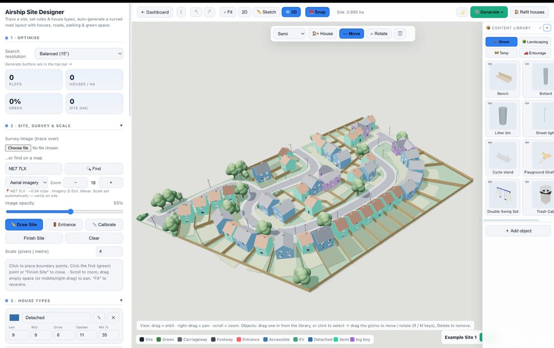
The 3D view in Airship Site Designer
Your 3D designstraight from the designer
~30 s
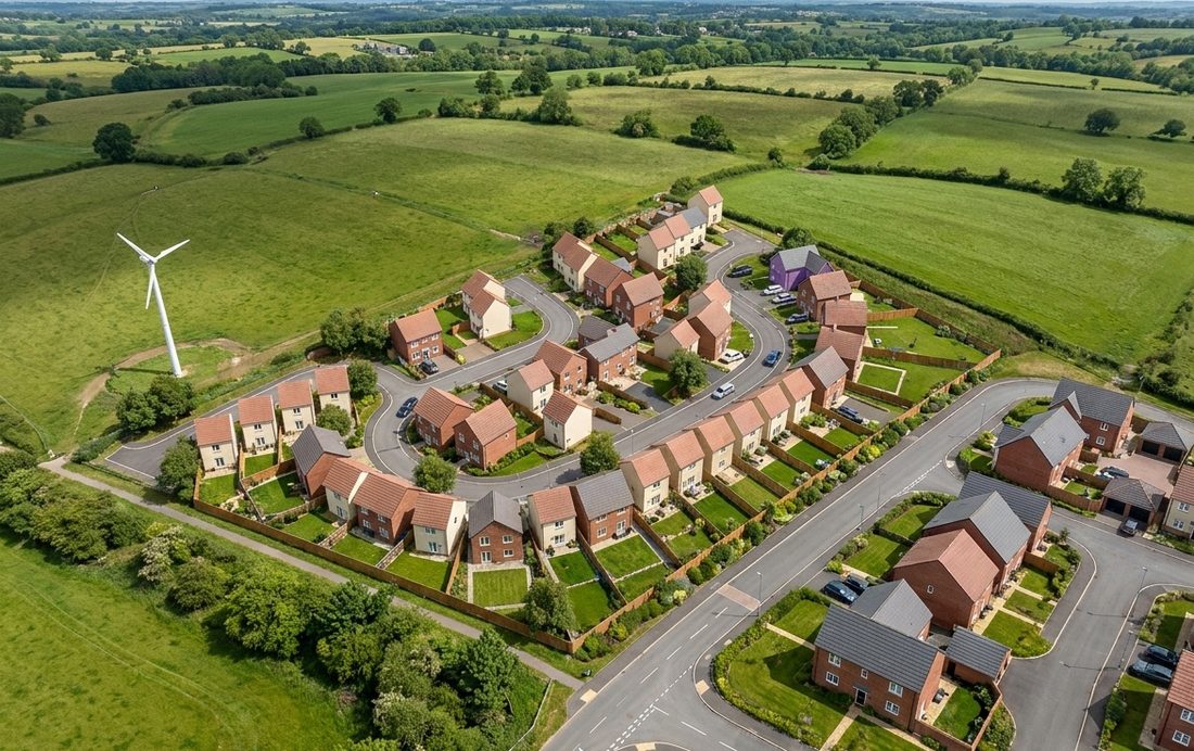
Photorealistic AI aerial render of the same estate
AI photo renderone prompt later
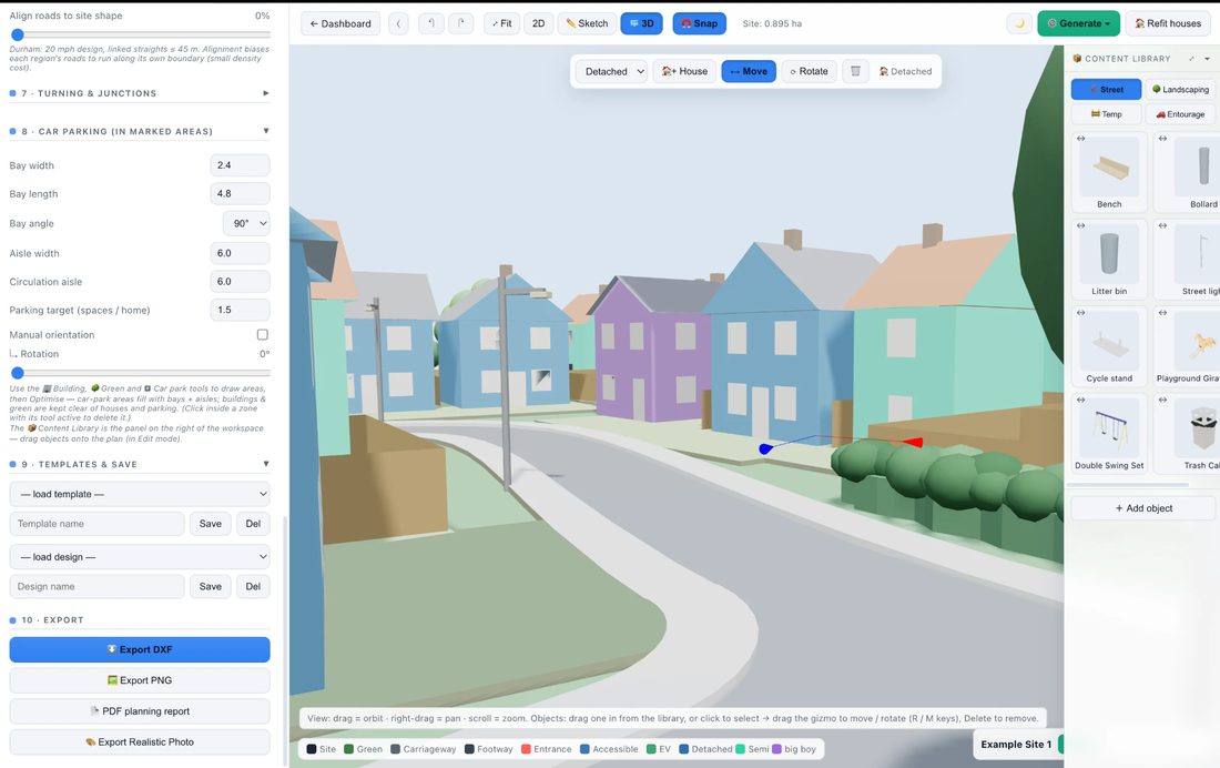
Street-level 3D view in Airship Site Designer
Street-level 3Dsame design, eye level
~30 s
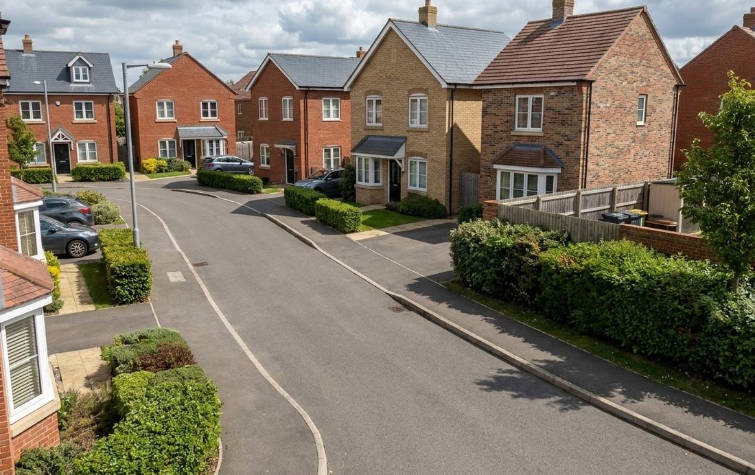
Photorealistic AI street-level render of the same estate
AI photo renderone prompt later

Works from any angle — aerial or street level. The layout stays true to your design: roads, plots and massing preserved. Included in every plan: Free 3 · Pro 25 · Studio 100 renders a month.

New — Site intelligence

See every constraint before you draw

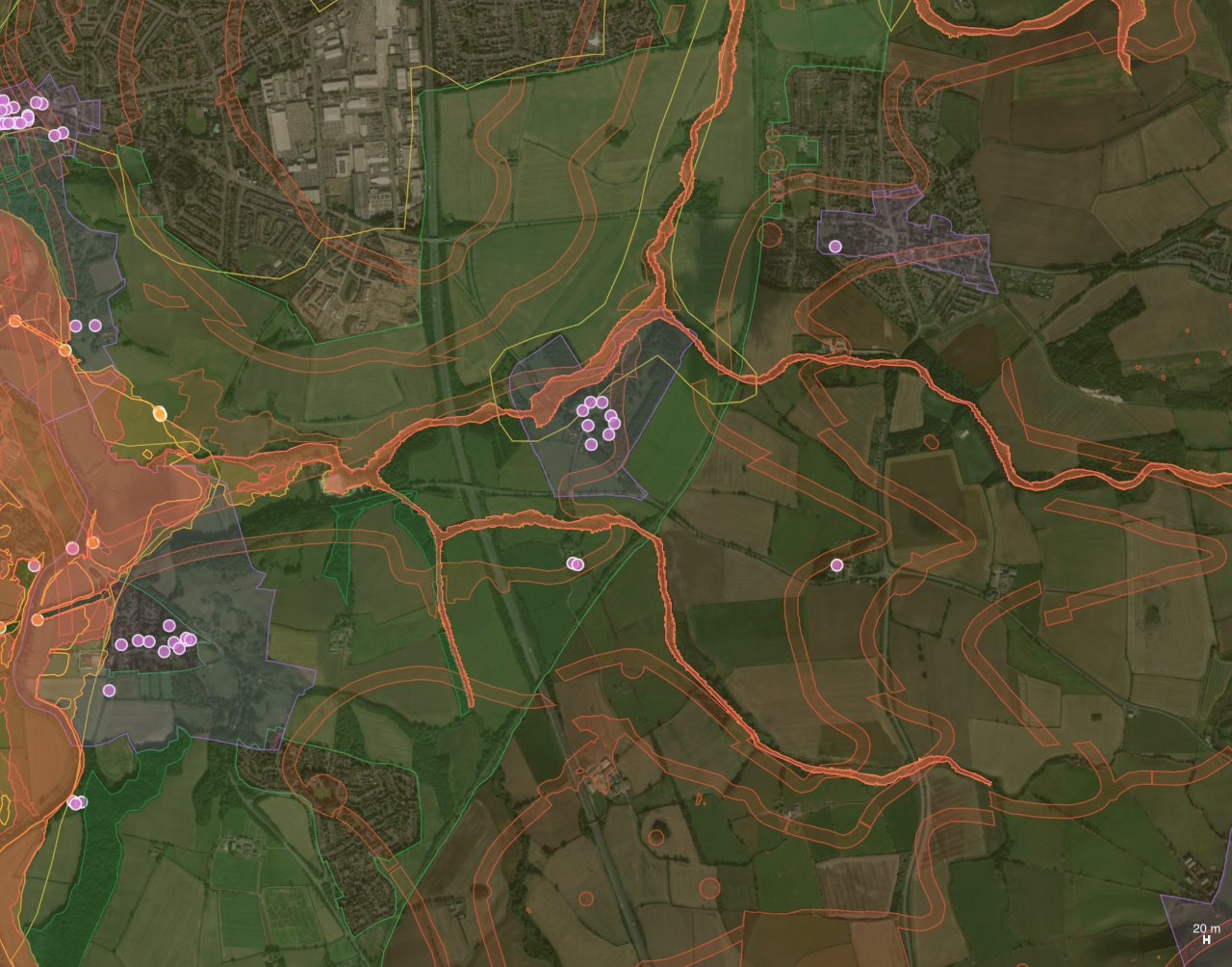
Search a postcode and Airship overlays 48 live GIS layers on your site map — flood zones, green belt, conservation areas, zoning & title boundaries, underground utilities & drainage, historic coal-mining risk, soil types and street-level crime — with an instant site-intelligence report for the exact spot.

GIS site-data layers — flood zones, green belt, conservation areas, coal-mining risk and listed buildings — overlaid on aerial imagery in Airship Site Designer
Site intelligencereal GIS layers on your site — from trusted UK sources

Flood, environment & heritage

Environment Agency Flood Zones 2 & 3, SSSIs, ancient woodland, AONBs and wetlands, plus conservation areas, listed buildings, scheduled monuments, green belt and Article 4 directions — drawn straight onto the aerial photo.

NEW

Services, drainage & mining

Underground power, pipelines, water & telecom, plus drains, ditches, culverts and manholes — and historic coal-mining legacy from the Coal Authority: development high-risk areas, coalfield consultation zones and licence areas.

NEW

Instant site report

Every planning constraint within 1.5 km listed with its distance from your postcode and a link to the official record, plus modelled air quality, the nearest DfT traffic count, flood zone, land use and Census 2021 population — for any UK location.

Pick exactly the layers you need — flood & water, landscape & nature, heritage, zoning & land, utilities & drainage, coal-mining legacy, soil types (USDA SSURGO) and crime rates (police.uk) — with hover tooltips on every area and pin, plus a separate opacity control for the map and the data. GIS overlays are included on Pro, Studio and Enterprise plans. Sources: planning.data.gov.uk, Environment Agency, Historic England, OpenStreetMap, Coal Authority, Open-Meteo, DfT, ONS. Indicative data — always verify with the relevant authority.

Everything in one tool

From boundary to buildable layout

Two designers in one — housing estates and surface car parks — with the controls planners and developers actually need.

One-click optimise

Generate a road & plot layout that maximises homes, then re-roll for alternatives — or refine it by hand.

Car parks too

Lay out bays, aisles and accessible spaces to UK standards — 90° or angled, with obstacle-aware routing.

Buildings, green & parking zones

Drop in keep-out buildings with real heights — they rise as solid blocks in 3D — plus landscaping and car-park areas the layout works around.

Standards-aware

Durham, Manual for Streets and parking presets built in — carriageway widths, kerb radii, bay sizes and more.

Full manual control

Draw and edit roads, aisles, footpaths and plots — with true spline curve handles for smooth bends. Nothing is locked.

NEW

AI photo renders

Turn the 3D view into a photorealistic aerial photo with a single prompt — same layout, real materials. Perfect for covers and client decks.

2D · Sketch · 3D views

Flip between the plan, a B&W planning-style sketch and a full 3D model of your estate. Auto plot numbering keeps drawings tidy.

House builder

Design house types in detail — storeys, roof shapes, windows, chimneys, porches and doors — drawn on plan and modelled in 3D.

Landscaping, trees & fences

Grass, shrubs, hedges and woodland with proper plan symbols and lush 3D planting — and Auto Fences to finish every garden.

NEW

66-object content library

Street furniture, playgrounds, site amenities, construction plant, vehicles and people — high-detail 3D models you drop on the plan, arrange in arrays and see in every view.

NEW

DXF, PDF & native Revit

Layered DXF for CAD, a multi-page PDF planning pack — and a genuine Revit model (.rvt) built in the cloud for Revit 2025/2026: site topography, roads, houses and planting as native elements.

Share with clients

Send a read-only link — no login needed. Stakeholders view the live layout in their browser.

Teams & versions

Shared workspaces, seats and snapshot history so your studio can collaborate and roll back any time.
Web + iPad

One designer — on your desk and on site

Airship Site Designer runs in your browser today, and a touch-first iPad app is on its way to the App Store. Same account, same designs, same releases — pick up a scheme on the iPad in the field, finish it at your desk.

COMING SOON

Touch-first on iPad

Pinch to zoom, drag to sketch and edit, long-press to delete, and a floating Done / Delete / rotate bar while you work — the full designer, rebuilt for fingers and Apple Pencil.

Every export, one tap

DXF, PDF planning reports, native Revit models and AI renders all flow straight into the iOS share sheet — AirDrop them to a colleague or save to Files on the spot.

Perfectly in sync

One account, one project list, one release cycle. Anything you design on the web opens on the iPad — and vice versa — with the same cloud library, GIS data and 3D view.

The iPad app is in final testing ahead of App Store review. Web works beautifully on iPad Safari in the meantime — same touch controls, no install needed.

Why Airship

Test more options, win more sites

Explore feasibility and maximise yield in the time it used to take to draw one option by hand.

Move faster

Answer "how many units fit?" instantly and iterate on the spot in client meetings.

Maximise yield

The optimiser packs plots and parking efficiently while respecting your rules and green space.

Design with confidence

Live warnings and standards presets keep layouts aligned with highway & parking guidance.

Pricing

Start free. Upgrade when it pays for itself.

Simple plans for solo designers and studios. Cancel anytime.

Free

£0
  • 2 saved designs
  • Estate & car-park optimiser
  • PNG export
  • Standards presets
  • 3 AI photo renders/mo
Get started
MOST POPULAR

Pro

£19/mo
  • Unlimited designs
  • DXF, PDF & native Revit (.rvt) export
  • No watermark
  • Site intelligence & 48 GIS data layers
  • Client share links
  • Version history
  • 25 AI photo renders/mo
Start with Pro

Studio

£79/mo
  • Everything in Pro
  • 100 AI photo renders/mo
  • Team workspace & seats
  • Shared templates
  • Priority support
Choose Studio

Enterprise

Let's Discuss
  • Everything in Studio
  • Unlimited AI photo renders
  • SSO (Azure AD / Okta)
  • White-label branding & custom domain
  • Dedicated onboarding & support
Talk to us
FAQ

Frequently asked questions

What is Airship Site Designer?

A browser-based tool that turns a site boundary into an optimised housing-estate or car-park layout in minutes — roads, plots, parking and landscaping — with full 3D, photorealistic AI renders, and DXF/PDF export for feasibility and planning work.

Do I need CAD software or training?

No. Everything runs in your browser with no CAD licence and no steep learning curve. Trace your boundary (over a survey image or map), set your rules, and generate — you can refine every road, plot and fence by hand afterwards.

Which UK design standards does it follow?

Presets for Durham County Council residential design guidance and Manual for Streets are built in — carriageway and footway widths, kerb radii, turning heads, visibility and parking bay dimensions — with live warnings when a layout drifts outside guidance. Outputs are indicative and should be verified against the current adopted local standard.

Can I export to AutoCAD or share with clients?

Yes — layered DXF export drops straight into AutoCAD, the multi-page PDF planning pack covers density, mix, parking ratio and green space, and read-only share links let clients view the live design in their browser with no login.

Can I export a Revit model?

Yes — Pro plans can export a genuine native Revit file (.rvt) for Revit 2025 or 2026, built in the cloud by a real Revit engine. The site arrives as proper Revit elements: a Toposolid site with garden sub-divisions, road and footway floors, fence walls, your exact house geometry and placed library objects — with options for full houses or footprint pads only.

What are AI photo renders?

One click turns your 3D view into a photorealistic aerial or street-level photograph of the finished estate — same roads, same plots, real materials. Every plan includes a monthly allowance (Free 3 · Pro 25 · Studio 100 · Enterprise unlimited).

How much does it cost?

Start free (2 designs, PNG export, 3 AI renders a month). Pro is £19/month, Studio £79/month, and Enterprise — with SSO, white-labelling and unlimited renders — is priced individually. Cancel anytime.

Design your first site today.

Free to start — no credit card, no CAD licence.

Start designing today →